
Weather Underground: forecasts measured by the street, not by the city
Summary
Weather Underground builds its picture from hundreds of thousands of personal weather stations reporting in real time, so temperature, wind and rain are measured within a few kilometres of your door. Free for the core forecast and map, with a cheap subscription for extended outlooks.
Recommend- Name
- Weather Underground
- Version
- 20260922
- Pricing
- Free
- Open source
- Proprietary
- Operating system
- WebAndroidiOS
- Website
- https://www.wunderground.com/
- Updated
- 2026-10-06 21:55
Rain across the whole city does not help your street
A conventional forecast is built from airports and city weather offices, and its resolution is the city. A summer thunderstorm does not respect that grid. It lands on one street in the eastern quarter, soaks it for twenty minutes and leaves the rest of the map dry. Weather Underground attacks the resolution problem instead of the wording. It runs one of the largest networks of private weather stations anywhere, with more than two hundred and fifty thousand of them uploading measured readings in real time, which puts a genuine thermometer, anemometer and rain gauge within a few kilometres of most people. The forecast it produces drops to the scale of a neighbourhood microclimate.
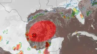
The difference is easiest to feel in summer. A city wide sentence tells you to carry an umbrella; a station two streets away tells you it has already rained there and stopped. One of those is a plan, the other is a shrug.
A map that rewards curiosity
The map view is the most playful part of the product. Radar returns, storm tracks, temperature distribution and live camera images stack in layers, so you can watch a front approach rather than wait for a notification to tell you it arrived. In storm season the time slider lets you rewind a track and see how it behaved; when heavy rain is forecast you can watch which way the returns are moving and decide whether to leave now or wait twenty minutes. That is far more settling than refreshing a push alert.
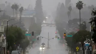
History is there as well. Going back through past readings and monthly climate summaries is friendly to anyone doing research or writing a report, and the data side is open enough that a number of other weather applications are built on top of this network rather than on their own instruments.
The point this service proves is that the precision of weather data can be carried by thousands of enthusiasts at once. Every station on a roof moves the forecast one step closer to ordinary life.
The business model is plain. The free tier covers the core forecast and the map, with promotional content in the interface. A modest subscription removes the promotion and unlocks an extended outlook running to fifteen days along with more detailed forecast charts. Whether that is worth paying for depends on how often a two week horizon actually changes a decision.
The limits are worth stating too. Private stations are far denser in Europe and North America than in China, so the street level advantage thins out in some regions. The product also leans towards data and a professional reading of it, and the visual polish is behind the weather apps that are designed around looking good. Anyone who wants a pretty card with a sun on it will find this one cluttered.
For people who genuinely care about the details, and who have outdoor decisions to make on the strength of them, the trade is the right way round: more measurement, less decoration.
What that changes is the shape of the question you ask. A city forecast answers whether it will rain; a station map answers whether it will rain on you, in the next hour, on the route you are about to take. The second question is the one people actually have before a bicycle ride or a delivery run.
None of this is a substitute for a meteorologist. It is a substitute for guessing, and guessing is what most people do between the hourly update and the moment they step outside.
One caveat about expectations when travelling. In places where the network is thin, the app degrades politely into an ordinary forecast with a nice map attached, which is fine as long as you know that is what happened rather than assuming the readings are as dense everywhere as they are at home.
There is a practical habit that follows from this. Instead of reading one number for the city, you look at three or four stations around you and read the spread. When they agree, the forecast is dependable. When they disagree sharply, that disagreement is itself the information, and it usually means the edge of something is close by.