
Bigemap Pro keeps contours, slope and map output in one desktop window
Summary
Bigemap Pro is a domestic GIS data elements design package from Chengdu Bigemap: more than a hundred formats in, contours and hydrology out of DEM data, plus a layout module with legend, scale bar and A0 sheets.
Recommend- Name
- Bigemap Pro
- Version
- 15.4
- Pricing
- Paid
- Open source
- Proprietary
- Operating system
- WindowsLinuxmacOS
- Website
- https://www.bigemap.com
- Updated
- 2026-11-01 15:50
A GIS project burns its hours on plumbing, not on analysis
Ask anyone who runs spatial work for a living where the week went and the answer is rarely the analysis itself. Imagery gets read in one program, vectors get corrected in a second, contours get generated in a third, and the sheet that finally goes out is rebuilt from scratch in a layout tool. Bigemap Pro, developed by Chengdu Bigemap Data Processing, is aimed squarely at that stretch of wasted motion. The company describes it as a domestic GIS data elements design package, abbreviated DED, and the promise is narrow but concrete: data ingestion, spatial analysis, terrain processing and thematic map output all live inside the same desktop window, so a project does not have to be reassembled at every handover.
Getting the data in comes first
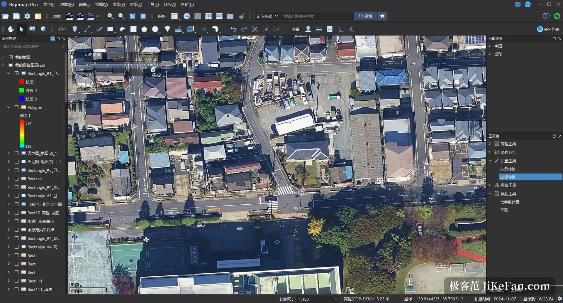
The program reads, edits, cleans and exports more than a hundred formats. On the vector side that covers SHP, KML, KMZ, DXF, DWG, GPX, CSV and TXT; on the raster side TIFF and JPG; for tiles and three dimensional work, MBTiles, OSGB and OBJ are on the list as well. Multi band rasters, satellite imagery, drone footage, vector layers and gridded data can sit in one project at the same time, and there is a prepared route for exchanging datasets with common CAD and modelling software, so a format conversion no longer means opening a second application first. The pipeline also anticipates volume: over a million object level vector features can be loaded and still browsed smoothly, which is the difference that shows up on village level settlement points, road networks and pipeline corridors, where features are packed densely.
Terrain analysis is where the weight sits
With a DEM or a DSM in hand, the software generates contour lines directly and can extract ridge lines and valley lines alongside them. Slope, aspect, surface curvature, roughness and flatness are all computed on demand. The hydrological side is present as a sequence rather than a single button: sink filling, flow direction, flow accumulation, watershed analysis and river network extraction can be walked through in order, cut and fill volumes can be calculated, profiles can be drawn, and elevation values can be picked at any point, along any line or across any area. For teams working on water conservancy, highway alignment, solar site selection or site levelling, the practical consequence is that elevation data no longer has to leave the project to be analysed; results stay where they were produced, and the labelling and cartography that follow can continue in the same file.
Editing tools and ready made features
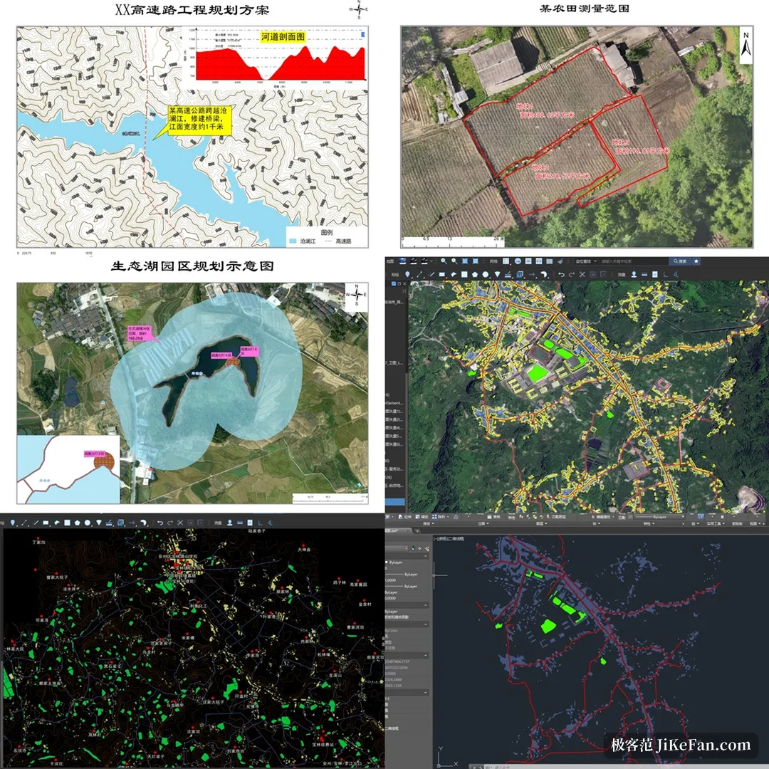
The editor collects the operations that come up every day: buffers, polygon clipping and merging, punching holes, erasing, duplicate detection and batch point insertion. Smart vectorisation turns features visible in imagery into a vector layer. Feature acquisition is broad, with road networks, water systems, building outlines, points of interest and administrative boundaries available by extent, the boundaries running down to township level and the building outlines carrying floor heights and a three dimensional white model. The usual way of working is to lay down that base data as a skeleton, stack the surveyed and designed layers on top, and then register the whole set so that everything lands where it belongs on the map.
Thematic output is the main event
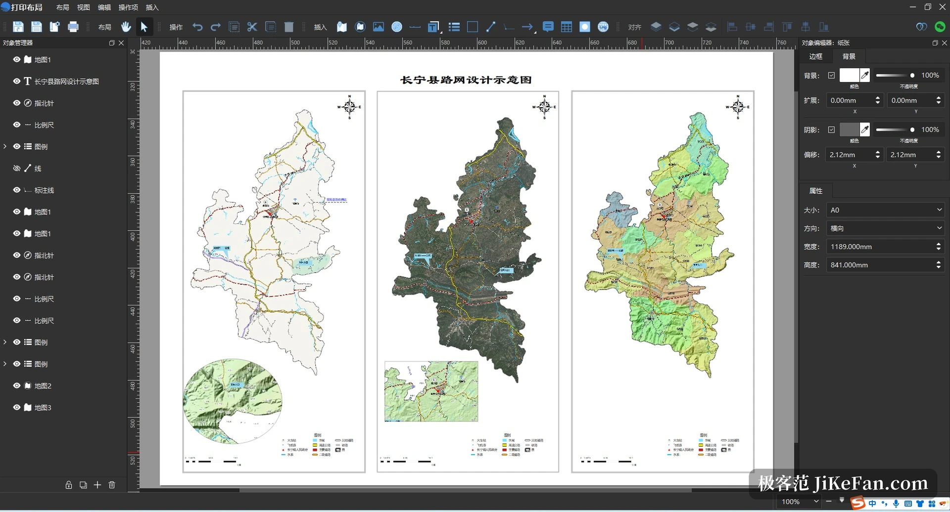
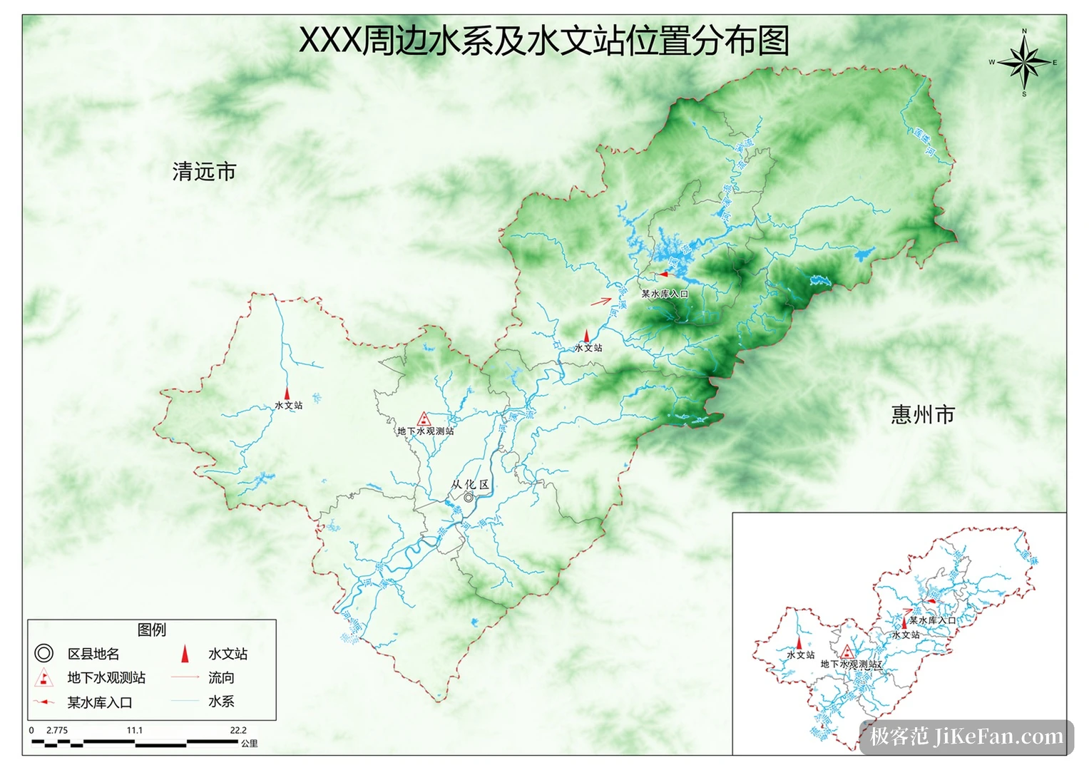
Map production is where a desktop tool of this kind earns its keep. A layout module is built in, with legend, scale bar, north arrow and graticule placed by dragging, sheet sizes running from ordinary page formats up to A0. Results export as PDF, as high resolution images, or as a georeferenced GeoTIFF basemap that can be handed to another analysis step later on. Symbol libraries for land administration, the third national land survey and flood control are included, and further libraries can be imported or built by hand so that the sheet matches the conventions of the industry it is drawn for. A water system map with hydrological stations, or a highway scheme drawing, can go from raw data to finished artwork without leaving the window.
Field and office joined by one account
Fieldwork and desk work are connected through the account: the desktop program and the phone app share one membership, project data syncs in both directions, and the phone handles marking, photo records and track collection before editing resumes on the computer. Once licensing moved to membership login, work follows the person rather than the machine, and enterprise seats can be reassigned between members per project instead of being tied to one fixed device. For teams with sensitive data there are private deployment and encrypted sharing options, and outgoing results can be made viewable without giving away the original data underneath them.
Version and the running promotion
The current build is v15.4.0.0, dated 26/7/2026, and besides Windows there are editions for domestic operating systems and for macOS. An annual Double 11 promotion is underway: the personal lifetime licence is at 83 percent of list price, adjusted from 30,000 to 25,000 yuan and bundled with a one year single user subscription; the five seat enterprise lifetime licence moves from 60,000 to 50,000 yuan; subscription plans are reduced by up to 6,200 yuan, with a five year price lock and twelve extra months of membership on offer. The page states a deadline of 20 November 2026, after which list prices return, and the detailed terms and eligibility are set out on the official promotion page.
If the working week already contains both elevation data to analyse and sheets to hand to a client or a review board, Bigemap Pro deserves a trial run on real ground: take one live project from import through contour generation to thematic output and see whether the sequence replaces the steps currently scattered across several programs. Whether to buy during the promotion is a separate question, and confirming the fit between the tool and the work is worth more time than the discount.